Back Taman Nasional Guadeloupe BAN Parc national de la Guadeloupe Danish Nationalpark Guadeloupe German Parque nacional de Guadalupe Spanish Guadalupeko parke nazionala Basque پارک ملی گوادلوپ Persian Parc national de la Guadeloupe French Guadeloupe Nemzeti Park Hungarian Parco nazionale della Guadalupa Italian Gvadelupos nacionalinis parkas Lithuanian
This article needs additional citations for verification. (September 2014) |
| Guadeloupe National Park | |
|---|---|
 | |
| Location | Basse-Terre Island, Guadeloupe (France) |
| Coordinates | 16°5′0″N 61°41′0″W / 16.08333°N 61.68333°W |
| Area | 173.0 km2 (66.8 sq mi) (core area) 162.0 km2 (62.5 sq mi) (buffer zone) 37.0 km2 (14.3 sq mi) (marine reserve) |
| Established | 1989 |
| Governing body | Parcs nationaux de France [1] |
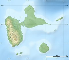
Guadeloupe National Park (French: Parc national de la Guadeloupe) is a national park in Guadeloupe, an overseas department of France located in the Leeward Islands of the eastern Caribbean region. The Grand Cul-de-Sac Marin Nature Reserve (French: Réserve Naturelle du Grand Cul-de-Sac Marin) is a marine protected area adjacent to the park and administered in conjunction with it. Together, these protected areas comprise the Guadeloupe Archipelago (French: l'Archipel de la Guadeloupe) biosphere reserve.
